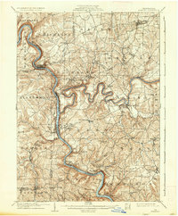
1908 Map of Foxburg
USGS Topo · Published 1937About this map
The Allegheny River and Clarion River dominate this turn-of-the-century landscape, carving deep, winding valleys through the plateau. This era shows a region transitioning between water-based industry and rail transport, with the Baltimore and Ohio and Pennsylvania railroads following the riverbanks to serve coal and iron operations. Industrial history is evident at Canoe Furnace and Sarah Furnace, while active extraction is documented at the Eagle Mine and Blue Goose Mine.
Find a feature on this map
89 named features on this map. Tap any name to fly to it.
Don’t see what you’re looking for? This feature index may not catch every label — zoom into the map to look around manually.
Map Details
Editions of this 1908 Foxburg Map
5 editions found
Other maps of this area

1900 · Kittanning
USGS Topo · 1:62,500

1901 · Rural Valley
USGS Topo · 1:62,500

1902 · Kittanning
USGS Topo · 1:62,500

1903 · Rural Valley
USGS Topo · 1:62,500

1906 · Clarion
USGS Topo · 1:62,500

1907 · Clarion
USGS Topo · 1:62,500

1907 · Foxburg
USGS Topo · 1:62,500

1908 · Foxburg
USGS Topo · 1:62,500

1909 · Franklin
USGS Topo · 1:62,500

1909 · Butler
USGS Topo · 1:62,500