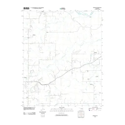
2009 Map of Francis
USGS Topo · Published 2009About this map
The town of Francis sits at the northern edge of this landscape, where the local road network fans out across the rolling terrain of Pontotoc County. The geography is defined by a dense system of waterways, including the winding Muddy Boggy Creek, Sincere Creek, and the Canadian River visible in the northeast corner. This 2009 survey reveals a rural area with numerous family-named landmarks and small-scale infrastructure, such as the Warren Hogue Dam and Engel Lake Dam. Genealogists will find this map particularly useful for identifying the distribution of local burial grounds, including the Kilcrease Cemetery, Oakman Cemetery, and Fivemile Cemetery. The road system, with names like McCalls Church Rd and Cash Ranch Rd, reflects the agricultural and residential development of the early 21st century before modern urbanization reached this part of Oklahoma.
Find a feature on this map
57 named features on this map. Tap any name to fly to it.
Don’t see what you’re looking for? This feature index may not catch every label — zoom into the map to look around manually.
Map Details
Editions of this 2009 Francis Map
This is the sole edition of this map. No revisions or reprints were ever made.
Other maps of this area

1896 · Coalgate
USGS Topo · 1:125,000

1899 · Coalgate
USGS Topo · 1:125,000

1900 · Coalgate
USGS Topo · 1:125,000

1901 · Stonewall
USGS Topo · 1:125,000

1957 · Stonewall
USGS Topo · 1:24,000

1957 · Ardmore
USGS Topo · 1:250,000

1958 · Sasakwa
USGS Topo · 1:24,000

1958 · Lula
USGS Topo · 1:24,000

1958 · Francis
USGS Topo · 1:24,000

1958 · Steedman
USGS Topo · 1:24,000