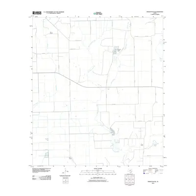
2010 Map of Francitas NE
USGS Topo · Published 2010About this map
Industrial energy production and coastal hydrology define this corner of Matagorda County. The landscape is marked by the presence of the Little Kentucky Oil Field, North Francitas Oil Field, and Midfield Oil Field, illustrating the area's continued reliance on oil extraction. These fields are situated within a drainage network shaped by East Carancahua Creek, Lunis Creek, and Moccasin Creek, which flow through the coastal plain toward the Gulf. Agricultural and water management infrastructure is evident near Reservoir Number 4 Dam, while a rigid grid of rural routes like Lincoln Ave and FM 3086 organizes the territory. This 2010 survey reflects a period where traditional energy industries and managed water resources remained the primary drivers of land use in this sparsely populated Texas region.
Find a feature on this map
32 named features on this map. Tap any name to fly to it.
Don’t see what you’re looking for? This feature index may not catch every label — zoom into the map to look around manually.
Map Details
Editions of this 2010 Francitas NE Map
This is the sole edition of this map. No revisions or reprints were ever made.
Other maps of this area

1951 · Danevang
USGS Topo · 1:24,000

1952 · Francitas NW
USGS Topo · 1:24,000

1952 · Francitas
USGS Topo · 1:24,000

1952 · Blessing
USGS Topo · 1:24,000

1952 · Francitas NE
USGS Topo · 1:24,000

1952 · Midfield
USGS Topo · 1:24,000

1952 · La Ward
USGS Topo · 1:24,000

1953 · Beeville
USGS Topo · 1:250,000

1953 · Seguin
USGS Topo · 1:250,000

1956 · Beeville
USGS Topo · 1:250,000