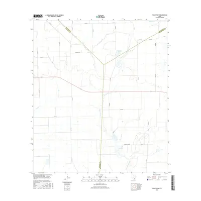
2016 Map of Francitas NE
USGS Topo · Published 2016About this map
E Carancahua Cr serves as a central drainage feature for this coastal prairie region, where the convergence of three Texas counties—Wharton, Jackson, and Matagorda—creates a complex web of local boundaries. The landscape is defined by an extensive grid of rural county roads, many bearing family names that reflect the local agricultural heritage. Water management is a visible priority for the area, evidenced by the presence of Reservoir Number 4 and the winding paths of Moccasin Cr and Lunis Cr. These waterways and man-made structures emphasize the intersection of natural hydrology and managed ranching or farming lands. The transition across county lines, such as the Wharton Co Matagorda Co boundary, highlights the jurisdictional divisions in this relatively flat, water-carved terrain, while routes like Lincoln Ave and FM 3086 provide the primary transit network through the open countryside.
Find a feature on this map
39 named features on this map. Tap any name to fly to it.
Don’t see what you’re looking for? This feature index may not catch every label — zoom into the map to look around manually.
Map Details
Editions of this 2016 Francitas NE Map
This is the sole edition of this map. No revisions or reprints were ever made.
Other maps of this area

1951 · Danevang
USGS Topo · 1:24,000

1952 · Francitas NW
USGS Topo · 1:24,000

1952 · Francitas
USGS Topo · 1:24,000

1952 · Blessing
USGS Topo · 1:24,000

1952 · Francitas NE
USGS Topo · 1:24,000

1952 · Midfield
USGS Topo · 1:24,000

1952 · La Ward
USGS Topo · 1:24,000

1953 · Beeville
USGS Topo · 1:250,000

1953 · Seguin
USGS Topo · 1:250,000

1956 · Beeville
USGS Topo · 1:250,000