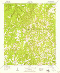
1957 Map of Frankfort
USGS Topo · Published 1958About this map
Frankfort sits at the center of this rural landscape, which spans the boundary of Colbert and Franklin Counties. The terrain is defined by a dense network of drainages, including Jackson Mill Creek, Cedar Creek, and Dunkin Creek, which have carved deep valleys into the plateau. The settlement pattern is largely decentralized, with community life revolving around remote landmarks like Wagnon Mountain Church and Lime Rock Sch.
Find a feature on this map
43 named features on this map. Tap any name to fly to it.
Don’t see what you’re looking for? This feature index may not catch every label — zoom into the map to look around manually.
Map Details
Editions of this 1957 Frankfort Map
3 editions found
Other maps of this area

1924 · Tuscumbia
USGS Topo · 1:48,000

1925 · Barton
USGS Topo · 1:62,500

1926 · Tuscumbia
USGS Topo · 1:62,500

1926 · Barton
USGS Topo · 1:48,000

1929 · Barton
USGS Topo · 1:62,500

1936 · Russellville
USGS Topo · 1:24,000

1936 · Frankfort
USGS Topo · 1:24,000

1936 · Pleasant Grove
USGS Topo · 1:24,000

1936 · Isbell
USGS Topo · 1:24,000

1936 · Pride
USGS Topo · 1:24,000