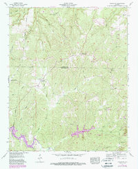
1957 Map of Frankfort
USGS Topo · Published 1988About this map
Russellville serves as the focal point in the southeast corner of this landscape, where the town's edge meets the industrial presence of a Strip mine and a Filtration Plant. This 1957 survey, updated with revisions from the 1980s, captures the rural character of the Colbert and Franklin County borderlands. The terrain is defined by the high ground of Wagnon Mountain and a dense network of watercourses including Cane Creek and Tollison Creek. Significant man-made water features such as Cedar Creek Lake and Elliott Lake dominate the southern half of the sheet.
Find a feature on this map
46 named features on this map. Tap any name to fly to it.
Don’t see what you’re looking for? This feature index may not catch every label — zoom into the map to look around manually.
Map Details
Editions of this 1957 Frankfort Map
3 editions found
Other maps of this area

1924 · Tuscumbia
USGS Topo · 1:48,000

1925 · Barton
USGS Topo · 1:62,500

1926 · Tuscumbia
USGS Topo · 1:62,500

1926 · Barton
USGS Topo · 1:48,000

1929 · Barton
USGS Topo · 1:62,500

1936 · Russellville
USGS Topo · 1:24,000

1936 · Frankfort
USGS Topo · 1:24,000

1936 · Pleasant Grove
USGS Topo · 1:24,000

1936 · Isbell
USGS Topo · 1:24,000

1936 · Pride
USGS Topo · 1:24,000