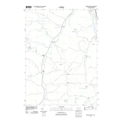
2010 Map of Franklin Forks
USGS Topo · Published 2010About this map
Snake Creek dictates the geography of this rural landscape as it winds through a series of small, established hamlets. The settlement pattern is defined by traditional crossroads communities such as Franklin Forks, Lawsville Center, and Brookdale, where local road networks like Baptist Hl and Howard Hill Rd converge. This 2010 survey illustrates a quiet transition between northern Pennsylvania and southern New York, anchored in the northeast by the Susquehanna River. Numerous small water bodies and dams characterize the drainage of the area, including Mingo Lake, Bel-Air Lake, and the larger DuBois Reservoir. Notable topographic landmarks like Stonecrop Hill and Roundtop rise above the creek valleys, while the presence of Kirkwood Airpark near the New York border indicates the modern aviation footprint on this otherwise agrarian and residential terrain.
Find a feature on this map
49 named features on this map. Tap any name to fly to it.
Don’t see what you’re looking for? This feature index may not catch every label — zoom into the map to look around manually.
Map Details
Editions of this 2010 Franklin Forks Map
This is the sole edition of this map. No revisions or reprints were ever made.
Other maps of this area

1904 · Binghamton
USGS Topo · 1:62,500

1905 · Nineveh
USGS Topo · 1:62,500

1932 · Susquehanna
USGS Topo · 1:62,500

1935 · Binghamton West
USGS Topo · 1:24,000

1935 · Susquehanna
USGS Topo · 1:62,500

1937 · Binghamton East
USGS Topo · 1:24,000

1942 · Binghamton West
USGS Topo · 1:31,680

1942 · Binghamton East
USGS Topo · 1:31,680

1943 · Montrose
USGS Topo · 1:62,500

1945 · Montrose
USGS Topo · 1:62,500