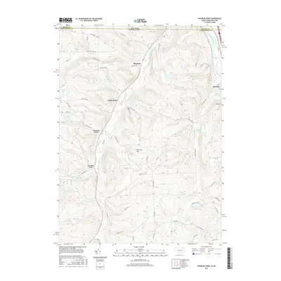
2016 Map of Franklin Forks
USGS Topo · Published 2016About this map
Snake Creek dictates the geography of this borderland region, winding northward through the valley from Franklin Forks toward the Susquehanna River. This 2016 survey documents the rural character of Susquehanna County, Pennsylvania, and its transition into Broome County, New York. Small hubs like Lawsville Center and Brookdale are connected by a dense network of country roads named for the families and terrain they traverse, including Howard Hill Rd and Barbour Hill Rd.
Find a feature on this map
65 named features on this map. Tap any name to fly to it.
Don’t see what you’re looking for? This feature index may not catch every label — zoom into the map to look around manually.
Map Details
Editions of this 2016 Franklin Forks Map
This is the sole edition of this map. No revisions or reprints were ever made.
Other maps of this area

1904 · Binghamton
USGS Topo · 1:62,500

1905 · Nineveh
USGS Topo · 1:62,500

1932 · Susquehanna
USGS Topo · 1:62,500

1935 · Binghamton West
USGS Topo · 1:24,000

1935 · Susquehanna
USGS Topo · 1:62,500

1937 · Binghamton East
USGS Topo · 1:24,000

1942 · Binghamton West
USGS Topo · 1:31,680

1942 · Binghamton East
USGS Topo · 1:31,680

1943 · Montrose
USGS Topo · 1:62,500

1945 · Montrose
USGS Topo · 1:62,500