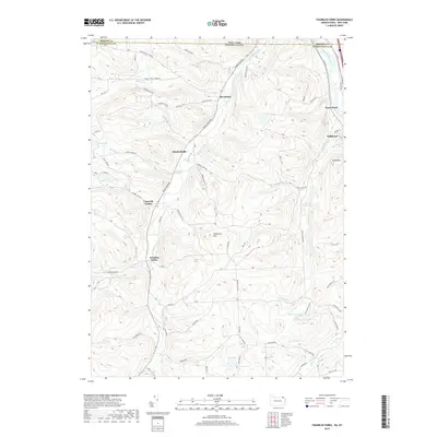
2019 Map of Franklin Forks
USGS Topo · Published 2019About this map
Snake Creek carves a deep valley through this Pennsylvania borderland, serving as the primary corridor for settlements like Brookdale, Stanfordville, and Franklin Forks. To the east, the Susquehanna River loops through Great Bend and Hallstead, while the uplands are dotted with small glacial lakes and reservoirs, including Oteyokwa Lake and the DuBois Reservoir. The landscape is defined by its agricultural and forested character, with many roads named for local families and landmarks, such as Barbour Hill Rd, Franklin Hill Rd, and Baptist Hill.
Find a feature on this map
71 named features on this map. Tap any name to fly to it.
Don’t see what you’re looking for? This feature index may not catch every label — zoom into the map to look around manually.
Map Details
Editions of this 2019 Franklin Forks Map
This is the sole edition of this map. No revisions or reprints were ever made.
Other maps of this area

1904 · Binghamton
USGS Topo · 1:62,500

1905 · Nineveh
USGS Topo · 1:62,500

1932 · Susquehanna
USGS Topo · 1:62,500

1935 · Binghamton West
USGS Topo · 1:24,000

1935 · Susquehanna
USGS Topo · 1:62,500

1937 · Binghamton East
USGS Topo · 1:24,000

1942 · Binghamton West
USGS Topo · 1:31,680

1942 · Binghamton East
USGS Topo · 1:31,680

1943 · Montrose
USGS Topo · 1:62,500

1945 · Montrose
USGS Topo · 1:62,500