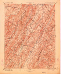
1896 Map of Franklin
USGS Topo · Published 1914About this map
Franklin and the winding South Branch Potomac River anchor this late-19th-century reconnaissance, which charts a landscape defined by the parallel ridges of the Alleghenies. The map captures an era of isolated mountain settlements and early river-valley agriculture, long before modern highways bypassed these gaps. Key crossings like Kline Cross Roads and riverfront points like Upper Tract and Fort Seybert represent the vital hubs for local commerce and communication during this period. The survey also notes essential industrial landmarks like a Grist Mill near Riverton, serving as evidence of the localized economy that sustained these West Virginia and Virginia borderlands. From the heights of the Allegany Front to the resort-adjacent terrain of Rawley Springs, the map detail reveals a world of named knobs and gaps that shaped the movement of goods and people across Pendleton Co and its neighbors.
Find a feature on this map
113 named features on this map. Tap any name to fly to it.
Don’t see what you’re looking for? This feature index may not catch every label — zoom into the map to look around manually.
Map Details
Editions of this 1896 Franklin Map
4 editions found

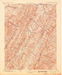
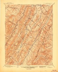
Other maps of this area

1886 · St. George
USGS Topo · 1:125,000

1889 · Beverly
USGS Topo · 1:125,000

1891 · St. George
USGS Topo · 1:125,000

1891 · Romney
USGS Topo · 1:125,000

1892 · Beverly
USGS Topo · 1:125,000

1892 · Franklin
USGS Topo · 1:125,000

1892 · Woodstock
USGS Topo · 1:125,000

1892 · Harrisonburg
USGS Topo · 1:125,000

1894 · Staunton
USGS Topo · 1:125,000

1895 · Piedmont
USGS Topo · 1:125,000