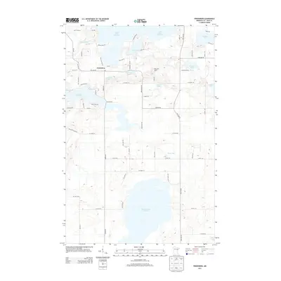
2013 Map of Fredenberg
USGS Topo · Published 2013About this map
Island Lake Reservoir and Wild Rice Lake Reservoir dominate this Saint Louis County landscape, illustrating a complex hydrological system used for water storage and power regulation. The small settlement of Fredenberg sits at a central crossroads, surrounded by numerous smaller water bodies such as Fredenberg Lake, Deepwater Lake, and Clearwater Lake. The terrain is marked by the winding courses of the Cloquet River and Beaver River, which navigate the low-lying areas between the reservoirs. Human activity in the early 21st century is evidenced by a dense network of local roads including Fish Lake Rd and Rice Lake Rd, as well as the Mirror Lake Lookout Tower, a significant local landmark providing a vantage point over the wooded, lake-dotted interior.
Find a feature on this map
63 named features on this map. Tap any name to fly to it.
Don’t see what you’re looking for? This feature index may not catch every label — zoom into the map to look around manually.
Map Details
Editions of this 2013 Fredenberg Map
This is the sole edition of this map. No revisions or reprints were ever made.
Other maps of this area

1895 · Duluth
USGS Topo · 1:62,500

1953 · Twig
USGS Topo · 1:24,000

1953 · Shaw
USGS Topo · 1:24,000

1953 · Adolph
USGS Topo · 1:24,000

1953 · Arnold
USGS Topo · 1:24,000

1953 · Duluth
USGS Topo · 1:24,000

1953 · Duluth Heights
USGS Topo · 1:24,000

1953 · Boulder Lake Reservoir
USGS Topo · 1:24,000

1953 · Fredenberg
USGS Topo · 1:24,000

1953 · Duluth
USGS Topo · 1:62,500