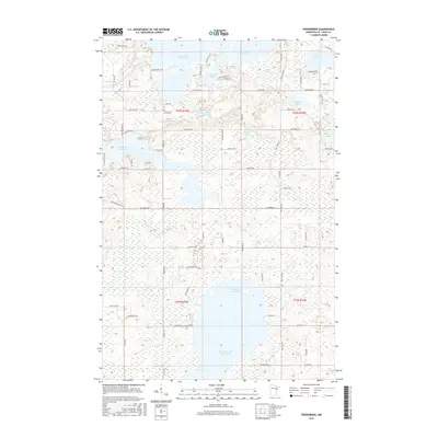
2016 Map of Fredenberg
USGS Topo · Published 2016About this map
Island Lake Reservoir and Wild Rice Lake Reservoir dominate this watery landscape in northern Saint Louis County. This 2016 survey illustrates the complex hydrography of the region, where the Cloquet River and Beaver River feed into extensive lake systems. The settlement of Fredenberg sits amidst a dense network of timber and residential access roads, including W Pioneer Rd and Rice Lake Rd, reflecting the area's development as a rural retreat and utility corridor. Smaller water bodies like Sunshine Lake, Fredenberg Lake, and Deepwater Lake fill the intervals between the major reservoirs. The grid-like arrangement of Township and Range lines, such as t52n r15w, provides a structured counterpoint to the irregular, winding shorelines of the glacial lakes.
Find a feature on this map
76 named features on this map. Tap any name to fly to it.
Don’t see what you’re looking for? This feature index may not catch every label — zoom into the map to look around manually.
Map Details
Editions of this 2016 Fredenberg Map
This is the sole edition of this map. No revisions or reprints were ever made.
Other maps of this area

1895 · Duluth
USGS Topo · 1:62,500

1953 · Twig
USGS Topo · 1:24,000

1953 · Shaw
USGS Topo · 1:24,000

1953 · Adolph
USGS Topo · 1:24,000

1953 · Arnold
USGS Topo · 1:24,000

1953 · Duluth
USGS Topo · 1:24,000

1953 · Duluth Heights
USGS Topo · 1:24,000

1953 · Boulder Lake Reservoir
USGS Topo · 1:24,000

1953 · Fredenberg
USGS Topo · 1:24,000

1953 · Duluth
USGS Topo · 1:62,500