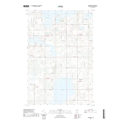
2019 Map of Fredenberg
USGS Topo · Published 2019About this map
Island Lake Reservoir and Wild Rice Lake Reservoir dominate this lake-rich landscape north of Duluth in Saint Louis County. This 2019 survey documents a complex hydrologic network where the Cloquet River and Beaver River feed into large managed reservoirs. The geography is defined by a high density of water bodies, including Fish Lake Reservoir, Fredenberg Lake, and Deepwater Lake, interspersed with extensive wetlands.
Find a feature on this map
74 named features on this map. Tap any name to fly to it.
Don’t see what you’re looking for? This feature index may not catch every label — zoom into the map to look around manually.
Map Details
Editions of this 2019 Fredenberg Map
This is the sole edition of this map. No revisions or reprints were ever made.
Other maps of this area

1895 · Duluth
USGS Topo · 1:62,500

1953 · Twig
USGS Topo · 1:24,000

1953 · Shaw
USGS Topo · 1:24,000

1953 · Adolph
USGS Topo · 1:24,000

1953 · Arnold
USGS Topo · 1:24,000

1953 · Duluth
USGS Topo · 1:24,000

1953 · Duluth Heights
USGS Topo · 1:24,000

1953 · Boulder Lake Reservoir
USGS Topo · 1:24,000

1953 · Fredenberg
USGS Topo · 1:24,000

1953 · Duluth
USGS Topo · 1:62,500