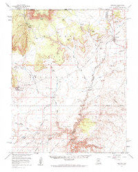
1954 Map of Fredonia
USGS Topo · Published 1963About this map
Pipe Spring National Monument and the Kaibab Indian Reservation anchor this mid-century survey of the Arizona Strip near the Utah border. The landscape is defined by its vital water sources and traditional transit routes, including Indian Moccasin and the Fredonia settlement. The map reveals a complex network of springs and crossings essential for cattle ranching and travel in this arid region, such as Boose Crossing and Nagles Crossing on the winding Kanab Creek.
Find a feature on this map
50 named features on this map. Tap any name to fly to it.
Don’t see what you’re looking for? This feature index may not catch every label — zoom into the map to look around manually.
Map Details
Editions of this 1954 Fredonia Map
3 editions found

Other maps of this area

1886 · Kanab
USGS Topo · 1:250,000

1886 · Kaibab
USGS Topo · 1:250,000

1953 · Cedar City
USGS Topo · 1:250,000

1953 · Grand Canyon
USGS Topo · 1:250,000

1954 · Kanab SW
USGS Topo · 1:24,000

1954 · Fredonia NW
USGS Topo · 1:24,000

1954 · Kanab SE
USGS Topo · 1:24,000

1954 · Shinarump NW
USGS Topo · 1:24,000

1954 · Short Creek SE
USGS Topo · 1:24,000

1954 · Fredonia SW
USGS Topo · 1:24,000