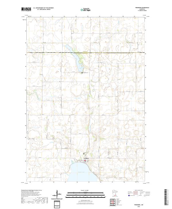
2022 Map of Freeborn
USGS Topo · Published 2022About this map
Freeborn sits on the northern shore of Freeborn Lake, serving as a central hub for the surrounding agricultural landscape in this 2022 survey. The town's historic footprint is anchored by the Freeborn Cem and a local Po, while the rural countryside to the north and west is defined by a complex network of waterways and drainage systems. The Cobb River and its various tributaries, including the Cobb Cr Ditch and Cobb Cr, carve through the townships, illustrating the managed water system essential to this region of Minnesota. Higher elevation points and scattered wetlands surround smaller water bodies like Trenton Lake and Spicer Lake. Local genealogy and land use can be traced through the placement of rural landmarks like the Seven Day Cem and the strictly partitioned grid of county roads, such as Co Rd 64 and Co Hwy 10, which span the border between Waseca Co and Freeborn Co.
Find a feature on this map
59 named features on this map. Tap any name to fly to it.
Don’t see what you’re looking for? This feature index may not catch every label — zoom into the map to look around manually.
Map Details
Editions of this 2022 Freeborn Map
This is the sole edition of this map. No revisions or reprints were ever made.
Other maps of this area

1954 · Albert Lea
USGS Topo · 1:62,500

1954 · Mason City
USGS Topo · 1:250,000

1955 · Wells
USGS Topo · 1:62,500

1957 · Mason City
USGS Topo · 1:250,000

1958 · Mason City
USGS Topo · 1:250,000

1967 · Waldorf
USGS Topo · 1:24,000

1967 · Freeborn
USGS Topo · 1:24,000
1967 · Otisco
USGS Topo · 1:24,000
1967 · Matawan
USGS Topo · 1:24,000

1967 · Hartland
USGS Topo · 1:24,000