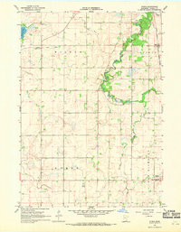
1967 Map of Otisco
USGS Topo · Published 1969About this map
Otisco and New Richland serve as the primary hubs in this Waseca County landscape, where the agricultural character of the late 1960s is defined by an extensive water management system. The winding Le Sueur River and its tributary, Boot Creek, are supplemented by engineered waterways like County Ditch No 20 and County Ditch No 35, illustrating the region's efforts to reclaim and maintain productive prairie farmland. Near the southern edge of the survey, the New Richland townsite includes modern infrastructure such as a Sewage Disposal plant and a nearby Landing Strip.
Find a feature on this map
17 named features on this map. Tap any name to fly to it.
Don’t see what you’re looking for? This feature index may not catch every label — zoom into the map to look around manually.
Map Details
Editions of this 1967 Otisco Map
This is the sole edition of this map. No revisions or reprints were ever made.
Other maps of this area

1953 · Saint Paul
USGS Topo · 1:250,000

1954 · Mason City
USGS Topo · 1:250,000

1957 · Mason City
USGS Topo · 1:250,000

1958 · Mason City
USGS Topo · 1:250,000

1959 · Saint Paul
USGS Topo · 1:250,000

1962 · Meriden
USGS Topo · 1:24,000

1966 · Waseca
USGS Topo · 1:24,000

1966 · Janesville
USGS Topo · 1:24,000

1967 · Waldorf
USGS Topo · 1:24,000

1967 · Freeborn
USGS Topo · 1:24,000