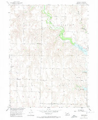
1956 Map of Freedom
USGS Topo · Published 1974About this map
Medicine Creek winds through the heart of this Frontier County landscape, feeding into the expansive Harry Strunk Lake. This 1956 survey, conducted as part of the Department of the Interior program for the development of the Missouri River Basin, illustrates the rural distribution of Frontier County’s early-twentieth-century educational and spiritual life. Small rural centers like Freedom and several scattered schools, including Champion Sch, Cottonwood Sch, and School No 92, anchor the community. The land is subdivided into large tracts including Sherman, Orafino, Knowles, and Garfield. Local burial sites such as Prairie Land Cem and a smaller Cem near the lake provide valuable points of reference for genealogists tracing families in these prairie townships. The map documents the terrain before further modernization, focusing on the water-cut valleys of Cedar Creek, Walnut Creek, and Lime Creek.
Find a feature on this map
18 named features on this map. Tap any name to fly to it.
Don’t see what you’re looking for? This feature index may not catch every label — zoom into the map to look around manually.
Map Details
Editions of this 1956 Freedom Map
2 editions found
Other maps of this area

1902 · Gothenburg
USGS Topo · 1:125,000

1954 · McCook
USGS Topo · 1:250,000

1956 · Freedom
USGS Topo · 1:24,000

1956 · Cambridge
USGS Topo · 1:24,000

1956 · Medicine Creek Dam
USGS Topo · 1:24,000

1956 · Stockville
USGS Topo · 1:24,000

1956 · Bartley NW
USGS Topo · 1:24,000

1956 · Bartley
USGS Topo · 1:24,000

1956 · Stockville SE
USGS Topo · 1:24,000

1957 · McCook
USGS Topo · 1:250,000