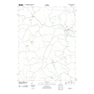
2010 Map of Freeport
USGS Topo · Published 2010About this map
Freeport and Londonderry serve as the primary anchors of this rural landscape, situated among a network of creeks and timbered ridges. The area is defined by its deep spiritual and community roots, evidenced by an exceptional concentration of burial grounds including the Scotch Covenanter Cemetery and the Pleasant Hill Methodist Protestant Cemetery. Industrial history is represented by the Crab Orchard Mine located east of Craborchard Creek, while the Freeport Post Office remains a central landmark in the village. The southern portion of the map transition into the recreational waters of Hidden Haven Lake, dammed near Millers Fork. The infrastructure is characterized by winding backroads like Friendly Ridge Rd and crossings such as the Skull Fork Bridge, illustrating a region that maintains its traditional agricultural and extractive character.
Find a feature on this map
74 named features on this map. Tap any name to fly to it.
Don’t see what you’re looking for? This feature index may not catch every label — zoom into the map to look around manually.
Map Details
Editions of this 2010 Freeport Map
This is the sole edition of this map. No revisions or reprints were ever made.
Other maps of this area

1902 · Scio
USGS Topo · 1:62,500

1903 · Flushing
USGS Topo · 1:62,500

1904 · Scio
USGS Topo · 1:62,500

1905 · Flushing
USGS Topo · 1:62,500

1909 · Antrim
USGS Topo · 1:48,000

1909 · Uhrichsville
USGS Topo · 1:62,500

1911 · Antrim
USGS Topo · 1:62,500

1911 · Uhrichsville
USGS Topo · 1:62,500

1951 · Canton
USGS Topo · 1:250,000

1953 · Canton
USGS Topo · 1:250,000