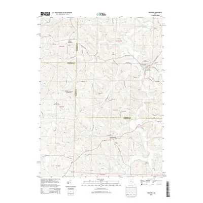
2013 Map of Freeport
USGS Topo · Published 2013About this map
Londonderry, Freeport, and West Chester serve as the primary hubs in this corner of eastern Ohio, where the borders of Guernsey, Harrison, and Tuscarawas counties converge. The landscape is defined by a dense network of watercourses including Stillwater Creek, Craborchard Cr, and Skull Fork, which dictate the winding paths of the local road system. Genealogists will find a high concentration of burial grounds, many associated with early religious congregations such as the Scotch Covenanter Cem, Pleasant Hill Methodist Protestant Cem, and Chestnut Hill United Brethren Cem. Notable landmarks such as the Skull Fork Bridge and Hidden Haven Lake anchor the rural landscape, while ridges like Chestnut Hill and Yankee Point rise above the drainage basins.
Find a feature on this map
93 named features on this map. Tap any name to fly to it.
Don’t see what you’re looking for? This feature index may not catch every label — zoom into the map to look around manually.
Map Details
Editions of this 2013 Freeport Map
This is the sole edition of this map. No revisions or reprints were ever made.
Other maps of this area

1902 · Scio
USGS Topo · 1:62,500

1903 · Flushing
USGS Topo · 1:62,500

1904 · Scio
USGS Topo · 1:62,500

1905 · Flushing
USGS Topo · 1:62,500

1909 · Antrim
USGS Topo · 1:48,000

1909 · Uhrichsville
USGS Topo · 1:62,500

1911 · Antrim
USGS Topo · 1:62,500

1911 · Uhrichsville
USGS Topo · 1:62,500

1951 · Canton
USGS Topo · 1:250,000

1953 · Canton
USGS Topo · 1:250,000