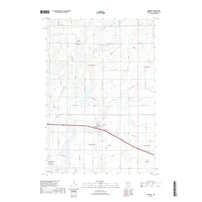
2019 Map of Freeport
USGS Topo · Published 2019About this map
The prairie and wetland landscape of Stearns County is centered on the agricultural community of Freeport, situated along a primary transportation corridor in the southern half of this study. The layout of the region is defined by a dense network of glacial basins and lakes, including the large waters of Kings Lake and Freeport Lake. To the north, the small settlement of St. Rosa serves as a local landmark, anchored by the Saint Rosa of Lima Cem. The southwest corner features New Munich, where the Immaculate Conception Cem marks the edge of the residential district. The terrain is characterized by a high concentration of small lakes like Wolf Lake and Rolling Lake, interspersed with rural cemeteries such as Millwood Cem and Ebenezer Cem, reflecting the early 20th-century township patterns of Central Minnesota that persist into the present day.
Find a feature on this map
47 named features on this map. Tap any name to fly to it.
Don’t see what you’re looking for? This feature index may not catch every label — zoom into the map to look around manually.
Map Details
Editions of this 2019 Freeport Map
This is the sole edition of this map. No revisions or reprints were ever made.
Other maps of this area

1950 · Swanville
USGS Topo · 1:62,500

1953 · Saint Cloud
USGS Topo · 1:250,000

1957 · Saint Cloud
USGS Topo · 1:250,000

1958 · Saint Cloud
USGS Topo · 1:250,000

1965 · Albany
USGS Topo · 1:24,000

1965 · Farming
USGS Topo · 1:24,000

1965 · Greenwald
USGS Topo · 1:24,000

1965 · Melrose
USGS Topo · 1:24,000

1965 · Freeport
USGS Topo · 1:24,000

1965 · St Martin
USGS Topo · 1:24,000