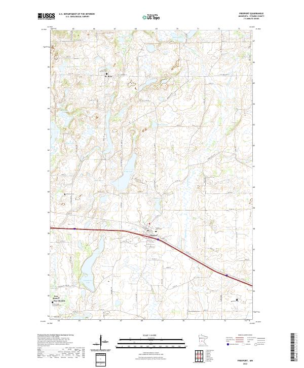
2022 Map of Freeport
USGS Topo · Published 2022About this map
Freeport serves as the central hub of this Stearns County landscape, situated along the corridor of Co Rd 157. The area is characterized by a high density of small lakes and wetlands, including Kings Lake and Millwood Lake, which influence the local road network. Genealogists will find significant value in the distribution of community religious sites, such as the Saint Rosa of Lima Cem near St. Rosa and the Immaculate Conception Cem in New Munich. These sites, along with Sacred Heart Cem and Ebenezer Cem, suggest a deeply rooted settlement pattern of scattered farming communities centered around parish life. The drainage of the land is defined by several watercourses, most notably Getchell Cr, which meanders through the eastern sections of the quadrangle near Rolling Lake.
Find a feature on this map
77 named features on this map. Tap any name to fly to it.
Don’t see what you’re looking for? This feature index may not catch every label — zoom into the map to look around manually.
Map Details
Editions of this 2022 Freeport Map
This is the sole edition of this map. No revisions or reprints were ever made.
Other maps of this area

1950 · Swanville
USGS Topo · 1:62,500

1953 · Saint Cloud
USGS Topo · 1:250,000

1957 · Saint Cloud
USGS Topo · 1:250,000

1958 · Saint Cloud
USGS Topo · 1:250,000

1965 · Albany
USGS Topo · 1:24,000

1965 · Farming
USGS Topo · 1:24,000

1965 · Greenwald
USGS Topo · 1:24,000

1965 · Melrose
USGS Topo · 1:24,000

1965 · Freeport
USGS Topo · 1:24,000

1965 · St Martin
USGS Topo · 1:24,000