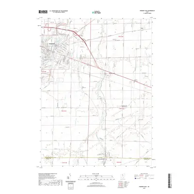
2019 Map of Fremont East
USGS Topo · Published 2019About this map
Fremont sits as a primary regional hub at the western edge of this 2019 survey, where the Sandusky River flows past Bradys Island and Rodger Young Park. The landscape to the east is defined by a dense network of country roads and drainage features such as Bark Cr and Ferguson Ditch, illustrating the area's rich agricultural heritage. In the southeastern corner, the settlement of Green Springs straddles the line between Sandusky and Seneca counties, anchored by Saint Francis Springs. Small hamlets like Erlin and numerous rural burial sites, including Whittlesey Cem and the Mount Lebanon Cem, are scattered across the terrain. Modern infrastructure is evident in the presence of the Sandusky County Regional Airport and the Norfolk Southern railroad line, which cuts diagonally across the rural townships toward the river.
Find a feature on this map
61 named features on this map. Tap any name to fly to it.
Don’t see what you’re looking for? This feature index may not catch every label — zoom into the map to look around manually.
Map Details
Editions of this 2019 Fremont East Map
This is the sole edition of this map. No revisions or reprints were ever made.
Other maps of this area

1901 · Bellevue
USGS Topo · 1:62,500

1901 · Fremont
USGS Topo · 1:62,500

1903 · Bellevue
USGS Topo · 1:62,500

1903 · Fremont
USGS Topo · 1:62,500

1906 · Tiffin
USGS Topo · 1:62,500

1915 · Siam
USGS Topo · 1:62,500

1956 · Toledo
USGS Topo · 1:250,000
1957 · Lindsey
USGS Topo · 1:24,000

1957 · Vickery
USGS Topo · 1:24,000
1957 · Wightmans Grove
USGS Topo · 1:24,000