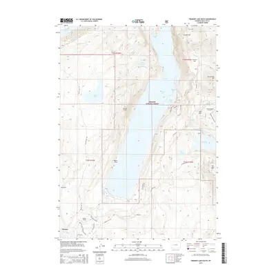
2015 Map of Fremont Lake South
USGS Topo · Published 2015About this map
The northern edge of Pinedale marks the gateway to a vast lacustrine landscape dominated by Fremont Lake and the Bridger National Forest. The geography is defined by a series of glacial lakes and distinct elevation changes, featuring prominent landmarks like Fremont Ridge and Higgins Point. Along the eastern shores, specialized access routes such as the North Sweeney Creek ATV and Grouse Mountain ATV trails weave through the timbered slopes near Kelly Park.
Find a feature on this map
45 named features on this map. Tap any name to fly to it.
Don’t see what you’re looking for? This feature index may not catch every label — zoom into the map to look around manually.
Map Details
Editions of this 2015 Fremont Lake South Map
This is the sole edition of this map. No revisions or reprints were ever made.
Other maps of this area

1909 · Fremont Peak
USGS Topo · 1:125,000

1955 · Thermopolis
USGS Topo · 1:250,000

1955 · Lander
USGS Topo · 1:250,000

1958 · Lander
USGS Topo · 1:250,000

1958 · Thermopolis
USGS Topo · 1:250,000

1961 · Lander
USGS Topo · 1:250,000

1962 · Thermopolis
USGS Topo · 1:250,000

1964 · Boulder Lake
USGS Topo · 1:24,000

1964 · Mount Airy
USGS Topo · 1:24,000
1964 · Cora
USGS Topo · 1:24,000