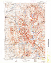
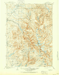
1909 Map of Fremont Peak
USGS Topo · Published 1933About this map
Union Pass and the Continental Divide anchor this high-altitude survey of the Wind River Range, as it appeared in the early twentieth century. The landscape is dominated by the headwaters of the Green River and Torrey Creek, where a network of remote homesteads like Lumans Ranch, McShirleys Ranch, and Woolery's Ranch trace the early ranching history of the region.
Find a feature on this map
100 named features on this map. Tap any name to fly to it.
Don’t see what you’re looking for? This feature index may not catch every label — zoom into the map to look around manually.
Map Details
Editions of this 1909 Fremont Peak Map
6 editions found
Other maps of this area

1902 · Mt Leidy
USGS Topo · 1:125,000

1904 · Kirwin
USGS Topo · 1:125,000

1905 · Younts Peak
USGS Topo · 1:125,000

1906 · Kirwin
USGS Topo · 1:125,000

1907 · Younts Peak
USGS Topo · 1:125,000

1907 · Gros Ventre
USGS Topo · 1:125,000

1909 · Fremont Peak
USGS Topo · 1:125,000

1910 · Gros Ventre
USGS Topo · 1:125,000

1938 · Mt Bonneville
USGS Topo · 1:62,500

1939 · Big Piney
USGS Topo · 1:125,000