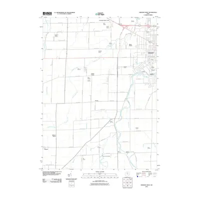
2010 Map of Fremont West
USGS Topo · Published 2010About this map
The Sandusky River flows through this Sandusky County landscape, defining the eastern edge of the survey area near the community of Ballville. Historically significant landmarks include the Mull Covered Bridge spanning the East Branch Wolf Creek and numerous cemeteries that reflect the early settlement of the region, such as Saint Marys Cemetery and Washington Chapel Cemetery. Small outlying communities like Stony Prairie, Havens, and Winters Station are connected by a grid of rural routes including Napoleon Rd and Hayes Ave. The drainage patterns of Muskellunge Creek and Wolf Creek dominate the interior, while aviation history is represented by the Fremont Airport and Gillmor Airport.
Find a feature on this map
64 named features on this map. Tap any name to fly to it.
Don’t see what you’re looking for? This feature index may not catch every label — zoom into the map to look around manually.
Map Details
Editions of this 2010 Fremont West Map
This is the sole edition of this map. No revisions or reprints were ever made.
Other maps of this area

1901 · Fostoria
USGS Topo · 1:62,500

1901 · Fremont
USGS Topo · 1:62,500

1901 · Elmore
USGS Topo · 1:62,500

1903 · Fremont
USGS Topo · 1:62,500

1903 · Fostoria
USGS Topo · 1:62,500

1903 · Elmore
USGS Topo · 1:62,500

1906 · Tiffin
USGS Topo · 1:62,500

1956 · Toledo
USGS Topo · 1:250,000
1957 · Lindsey
USGS Topo · 1:24,000
1957 · Wightmans Grove
USGS Topo · 1:24,000