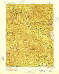
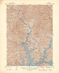
1948 Map of French Gulch
USGS Topo · Published 1948About this map
Gold mining operations and small settlements define the steep canyons along the Trinity Co Shasta Co line in the years following World War II. The landscape is dominated by the industrial legacy of the Klamath Mountains, where the historic French Gulch district supported numerous operations like the Brown Bear Mine, Gladstone Mine, and Milkmaid Mine. These sites are clustered around high ridges such as Highland Ridge and Summit, connected by trails and winding mountain roads that descend toward Clear Creek.
Find a feature on this map
111 named features on this map. Tap any name to fly to it.
Don’t see what you’re looking for? This feature index may not catch every label — zoom into the map to look around manually.
Map Details
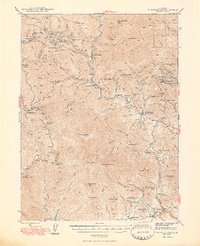
Editions of this 1948 French Gulch Map
2 editions found
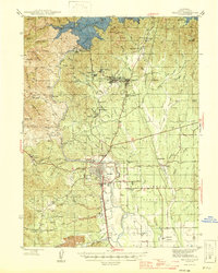
Other maps of this area

1890 · Red Bluff
USGS Topo · 1:250,000

1894 · Red Bluff
USGS Topo · 1:250,000

1901 · Redding
USGS Topo · 1:125,000

1913 · Weaverville
USGS Topo · 1:125,000

1932 · Olinda
USGS Topo · 1:31,680

1935 · Olinda
USGS Topo · 1:31,680
1944 · Redding
USGS Topo · 1:62,500
1944 · French Gulch
USGS Topo · 1:62,500
1946 · Lamoine
USGS Topo · 1:62,500
1946 · Redding
USGS Topo · 1:62,500