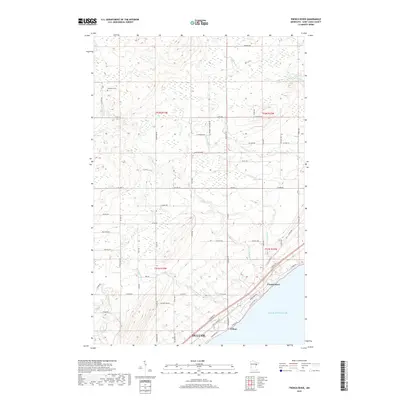
2019 Map of French River
USGS Topo · Published 2019About this map
French River and Clifton sit prominently along the North Shore of Lake Superior on this 2019 survey of the area northeast of Duluth. The map illustrates a dense network of watercourses draining the highlands into the lake, including the Lester River, Talmadge River, and the aptly named Big Sucker Cr. The inland portion of the quadrangle is largely defined by a grid of rural roads like Knife River Rd and Co Hwy 11, reflecting the long-established township and range surveying system. Near the headwaters of the French River, the Normanna Cem serves as a significant genealogical landmark for the surrounding rural community. The concentration of development along the lakeshore, particularly around Congdon Blvd and Co St Aid Hwy 61, shows the continued importance of the coastal corridor for transit and residence.
Find a feature on this map
63 named features on this map. Tap any name to fly to it.
Don’t see what you’re looking for? This feature index may not catch every label — zoom into the map to look around manually.
Map Details
Editions of this 2019 French River Map
This is the sole edition of this map. No revisions or reprints were ever made.
Other maps of this area

1895 · Duluth
USGS Topo · 1:62,500

1953 · Lakewood
USGS Topo · 1:24,000

1953 · French River
USGS Topo · 1:24,000

1953 · Arnold
USGS Topo · 1:24,000

1953 · Duluth
USGS Topo · 1:24,000

1953 · Knife River
USGS Topo · 1:24,000

1953 · Duluth
USGS Topo · 1:62,500

1953 · Ashland
USGS Topo · 1:250,000

1953 · Duluth
USGS Topo · 1:250,000

1954 · Barrs Lake
USGS Topo · 1:24,000