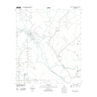
2012 Map of French Settlement
USGS Topo · Published 2012About this map
French Settlement and Port Vincent anchor this survey of the low-lying wetlands and bayous of Livingston Parish. The landscape is defined by the winding course of the Amite River and the significant engineering of the Amite River Diversion Canal, which cuts across the southern portion of the quadrangle. Smaller communities like Claybank, Summerfield, and Brignac are linked by a network of local roads such as Old Mill Settlement Rd and Mill Settlement Trce, reflecting the region’s long-standing connection to timber and waterborne trade.
Find a feature on this map
175 named features on this map. Tap any name to fly to it.
Don’t see what you’re looking for? This feature index may not catch every label — zoom into the map to look around manually.
Map Details
Editions of this 2012 French Settlement Map
This is the sole edition of this map. No revisions or reprints were ever made.
Other maps of this area

1892 · Mount Airy
USGS Topo · 1:62,500

1892 · Donaldsonville
USGS Topo · 1:62,500

1934 · Denham Springs
USGS Topo · 1:62,500

1934 · Springfield
USGS Topo · 1:62,500

1935 · Gonzales
USGS Topo · 1:31,680

1939 · Springfield
USGS Topo · 1:62,500

1939 · Denham Springs
USGS Topo · 1:62,500

1939 · Donaldsonville
USGS Topo · 1:62,500

1946 · Petite Amite River
USGS Topo · 1:31,680

1947 · Sorrento
USGS Topo · 1:31,680