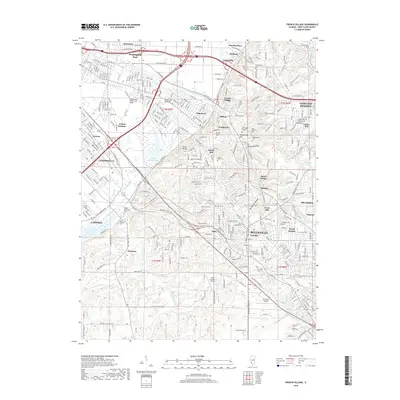
2018 Map of French Village
USGS Topo · Published 2018About this map
Belleville and its surrounding communities sit at a transition between the low-lying American Bottoms and the rising bluffs of the Signal Hill area. This 2018 survey documents a densely layered landscape of suburban expansion and historic sites, including numerous memorial grounds such as Saint Clair Memorial Park and Mount Carmel Cem. The drainage patterns of Harding Ditch and Schoenberger Cr define the lower elevations near Grand Marais Lake, while the upland terrain is marked by geographic features like Clarks Mound and Negro Hollow. Modern transit infrastructure is represented by the Metrolink rail corridor, which connects established neighborhoods like French Village, Edgemont, and Washington Park. The presence of small aviation facilities like Aero Estates Airport and Ben Emge Airport reflects the diverse land use of Saint Clair County.
Find a feature on this map
494 named features on this map. Tap any name to fly to it.
Don’t see what you’re looking for? This feature index may not catch every label — zoom into the map to look around manually.
Map Details
Editions of this 2018 French Village Map
This is the sole edition of this map. No revisions or reprints were ever made.
Other maps of this area

1888 · St. Louis
USGS Topo · 1:62,500

1907 · Belleville
USGS Topo · 1:62,500

1910 · Waterloo
USGS Topo · 1:62,500

1912 · New Athens
USGS Topo · 1:62,500

1913 · Waterloo
USGS Topo · 1:62,500

1931 · French Village
USGS Topo · 1:24,000

1933 · Granite City
USGS Topo · 1:24,000

1933 · Cahokia
USGS Topo · 1:24,000

1934 · Cahokia
USGS Topo · 1:24,000

1935 · French Village
USGS Topo · 1:24,000