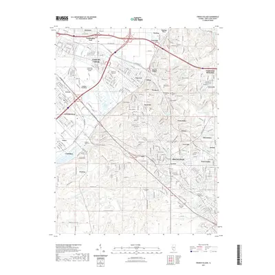
2021 Map of French Village
USGS Topo · Published 2021About this map
American Bottoms and the surrounding bluffs of St. Clair County define this highly developed region near the Mississippi. The settlement pattern is dense and multifaceted, connecting the industrial corridors of East St. Louis and Centreville with residential highlands such as Signal Hill and Winstanley Hill. The map meticulously records the numerous cemeteries that dot the landscape, including Mount Carmel Cem, Holy Cross Cem, and the Booker T Washington Cem, providing a detailed spatial record for family historians. Hydrological features like Grand Marais Lake and Harding Ditch illustrate the managed drainage of the lowlands. Educational and civic infrastructure is prominent, anchored by the Lindenwood University - Belleville campus, while varied neighborhoods such as Fairview Heights and Swansea show the continuous growth of the metropolitan area.
Find a feature on this map
372 named features on this map. Tap any name to fly to it.
Don’t see what you’re looking for? This feature index may not catch every label — zoom into the map to look around manually.
Map Details
Editions of this 2021 French Village Map
This is the sole edition of this map. No revisions or reprints were ever made.
Other maps of this area

1888 · St. Louis
USGS Topo · 1:62,500

1907 · Belleville
USGS Topo · 1:62,500

1910 · Waterloo
USGS Topo · 1:62,500

1912 · New Athens
USGS Topo · 1:62,500

1913 · Waterloo
USGS Topo · 1:62,500

1931 · French Village
USGS Topo · 1:24,000

1933 · Granite City
USGS Topo · 1:24,000

1933 · Cahokia
USGS Topo · 1:24,000

1934 · Cahokia
USGS Topo · 1:24,000

1935 · French Village
USGS Topo · 1:24,000