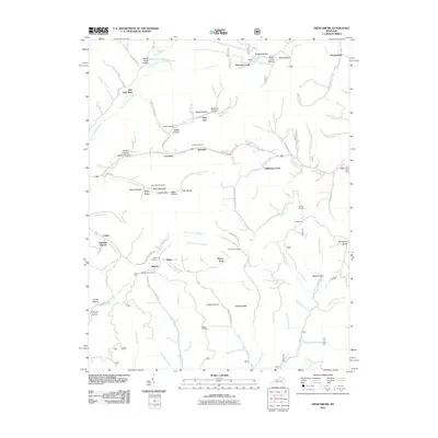
2011 Map of Frenchburg
USGS Topo · Published 2011About this map
Beaver Creek and the East Fork Slate Creek carve through the Menifee County landscape, defining the layout of small settlements like Rothwell and Dog Trot. The area is characterized by numerous hollows and ridges, such as McCausey Ridge and Wildcat Ridge, which have historically dictated the placement of homesteads and cemeteries. For genealogists, the map is a significant record of family lineage, preserving the locations of the Slusher Cemetery, Reffitt Cemetery, and Buchanan Cemetery.
Find a feature on this map
103 named features on this map. Tap any name to fly to it.
Don’t see what you’re looking for? This feature index may not catch every label — zoom into the map to look around manually.
Map Details
Editions of this 2011 Frenchburg Map
This is the sole edition of this map. No revisions or reprints were ever made.
Other maps of this area

1892 · Beattyville
USGS Topo · 1:125,000

1929 · Salt Lick
USGS Topo · 1:62,500

1934 · Salt Lick
USGS Topo · 1:62,500

1951 · Pomeroyton
USGS Topo · 1:24,000

1952 · Preston
USGS Topo · 1:24,000

1952 · Scranton
USGS Topo · 1:24,000

1952 · Frenchburg
USGS Topo · 1:24,000

1952 · Stanton
USGS Topo · 1:24,000

1952 · Means
USGS Topo · 1:24,000

1952 · Slade
USGS Topo · 1:24,000