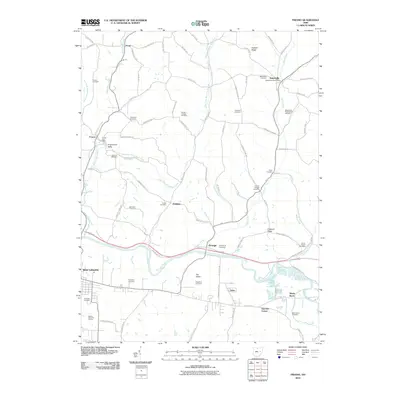
2010 Map of Fresno
USGS Topo · Published 2010About this map
Bakersville and West Lafayette anchor this portion of Coshocton County, where the southern valley of the Tuscarawas River meets a network of northern creeks. The landscape is defined by the winding paths of White Eyes Creek and Evans Creek, which carve through the terrain between prominent high points like Hothem Ridge and Chestnut Ridge. This 2010 survey documents a rural infrastructure heavily reliant on its township roads, connecting isolated settlements such as Pearl, Isleta, and Powell.
Find a feature on this map
91 named features on this map. Tap any name to fly to it.
Don’t see what you’re looking for? This feature index may not catch every label — zoom into the map to look around manually.
Map Details
Editions of this 2010 Fresno Map
This is the sole edition of this map. No revisions or reprints were ever made.
Other maps of this area

1908 · Conesville
USGS Topo · 1:62,500

1909 · Cambridge
USGS Topo · 1:62,500

1910 · Conesville
USGS Topo · 1:62,500

1911 · Newcomerstown
USGS Topo · 1:62,500

1912 · Cambridge
USGS Topo · 1:62,500

1913 · Newcomerstown
USGS Topo · 1:62,500

1913 · Coshocton
USGS Topo · 1:62,500

1915 · Coshocton
USGS Topo · 1:62,500

1943 · Coshocton
USGS Topo · 1:62,500

1943 · Newcomerstown
USGS Topo · 1:62,500