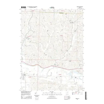
2016 Map of Fresno
USGS Topo · Published 2016About this map
The Tuscarawas River valley carves through this portion of Coshocton and Tuscarawas Counties, defining a landscape of high ridges and floodplains. To the south, The Plains and Chestnut Ridge overlook the river as it passes Isleta and West Lafayette. This area shows a high density of small family and community burial grounds, such as Woods College Cem, Clapboard Cem, and the Everal Chapel Cem, which are invaluable for genealogical research into the local farming families of Progressive Valley and Orange. The drainage network, including Evans Cr and White Eyes Creek, dictates the winding paths of rural routes like Coal Rd and Cadiz Rd, tracing the same lines used by early settlers to navigate these timbered highlands.
Find a feature on this map
54 named features on this map. Tap any name to fly to it.
Don’t see what you’re looking for? This feature index may not catch every label — zoom into the map to look around manually.
Map Details
Editions of this 2016 Fresno Map
This is the sole edition of this map. No revisions or reprints were ever made.
Other maps of this area

1908 · Conesville
USGS Topo · 1:62,500

1909 · Cambridge
USGS Topo · 1:62,500

1910 · Conesville
USGS Topo · 1:62,500

1911 · Newcomerstown
USGS Topo · 1:62,500

1912 · Cambridge
USGS Topo · 1:62,500

1913 · Newcomerstown
USGS Topo · 1:62,500

1913 · Coshocton
USGS Topo · 1:62,500

1915 · Coshocton
USGS Topo · 1:62,500

1943 · Coshocton
USGS Topo · 1:62,500

1943 · Newcomerstown
USGS Topo · 1:62,500