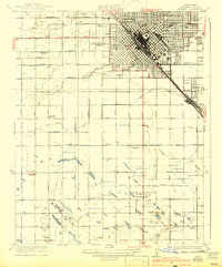
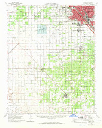
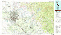
1960 Map of Fresno
USGS Topo · Published 1960About this map
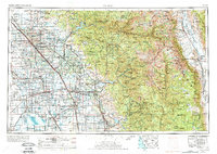
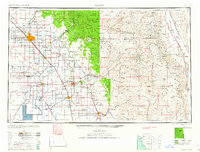
The Central Valley's agricultural heartland meets the high peaks of the Sierra Nevada in this mid-century survey. Irrigation and water management systems are central to the landscape, with the San Joaquin River, Kings River, and Kaweah River feeding a network of intensive farming. In the southwest, the distinctive basin of Tulare Lake and the Tule River highlight the drainage patterns of the southern valley. The urban center of Fresno is surrounded by a dense grid of smaller agricultural hubs and railroad sidings like Raisin City, Calwa City, and Malaga, many of which developed around the transportation corridors of the Southern Pacific Railroad and the Atchison Topeka and Santa Fe Railway.
Find a feature on this map
224 named features on this map. Tap any name to fly to it.
Don’t see what you’re looking for? This feature index may not catch every label — zoom into the map to look around manually.
Map Details
Editions of this 1960 Fresno Map
2 editions found
Historical Maps of Nanceville Through Time
10 maps found