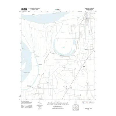
2012 Map of Friars Point
USGS Topo · Published 2012About this map
Friars Point occupies a prominent bend in the Mississippi River within this 2012 survey of Coahoma County. The landscape is defined by the complex hydrology of the Delta, where the river's historical path has left behind features like Horseshoe Lake, Horseshoe Bend, and Dustin Pond. Extensive levee systems and various landings, such as Houston Landing and Ledbetter Landing, speak to the long-standing efforts to manage the river for navigation and agriculture.
Find a feature on this map
72 named features on this map. Tap any name to fly to it.
Don’t see what you’re looking for? This feature index may not catch every label — zoom into the map to look around manually.
Map Details
Editions of this 2012 Friars Point Map
This is the sole edition of this map. No revisions or reprints were ever made.
Other maps of this area

1908 · Coahoma
USGS Topo · 1:24,000

1908 · Moon Lake
USGS Topo · 1:24,000

1910 · Coahoma
USGS Topo · 1:31,680

1912 · Moon Lake
USGS Topo · 1:31,680

1930 · Mellwood
USGS Topo · 1:62,500

1935 · Clarksdale
USGS Topo · 1:62,500

1939 · Farrell
USGS Topo · 1:62,500

1939 · Modoc
USGS Topo · 1:62,500

1939 · Clarksdale
USGS Topo · 1:62,500

1939 · Mellwood
USGS Topo · 1:62,500