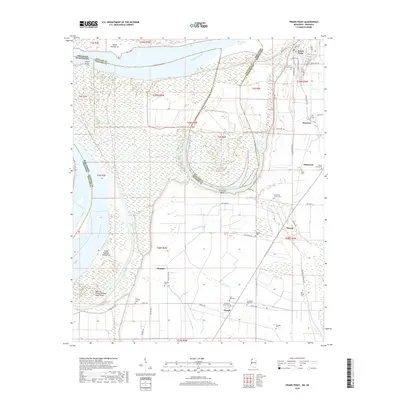
2018 Map of Friars Point
USGS Topo · Published 2018About this map
Friars Point stands as a prominent river town on this 2018 survey, situated along the complex hydrology of the Mississippi River and its associated oxbows. The landscape is defined by the massive Horseshoe Bend and the cut-off waters of Horseshoe Lake, illustrating the river's historical shifts. For the local historian or genealogist, the map reveals a dense network of burial grounds and small settlements scattered across the alluvial plain, including Stovall, Humber, and Farrell. The distribution of cemeteries like Zion Traveler Cem, Pee Dee Cem, and Lonesome Pine Cem hints at a deeply rooted community structure. Land features such as Island Number 61 and Island Number Sixtythree underscore the dynamic nature of the state boundary between Mississippi and Arkansas, where the river's old channels continue to shape modern geography.
Find a feature on this map
70 named features on this map. Tap any name to fly to it.
Don’t see what you’re looking for? This feature index may not catch every label — zoom into the map to look around manually.
Map Details
Editions of this 2018 Friars Point Map
This is the sole edition of this map. No revisions or reprints were ever made.
Other maps of this area

1908 · Coahoma
USGS Topo · 1:24,000

1908 · Moon Lake
USGS Topo · 1:24,000

1910 · Coahoma
USGS Topo · 1:31,680

1912 · Moon Lake
USGS Topo · 1:31,680

1930 · Mellwood
USGS Topo · 1:62,500

1935 · Clarksdale
USGS Topo · 1:62,500

1939 · Farrell
USGS Topo · 1:62,500

1939 · Modoc
USGS Topo · 1:62,500

1939 · Clarksdale
USGS Topo · 1:62,500

1939 · Mellwood
USGS Topo · 1:62,500