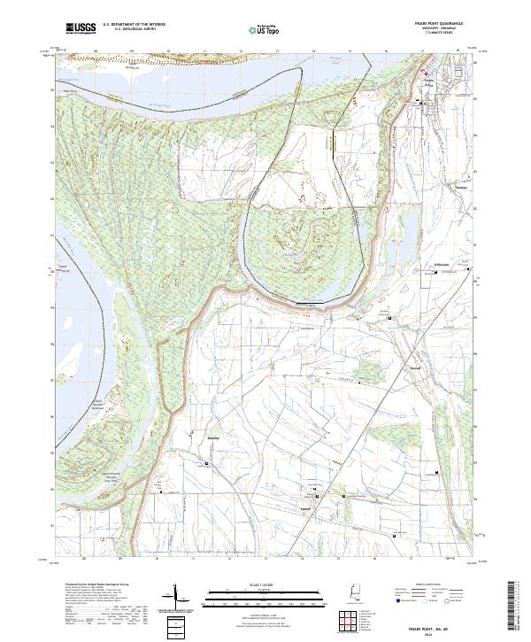
2024 Map of Friars Point
USGS Topo · Published 2024About this map
The Mississippi River forms a dynamic boundary in this western Coahoma County landscape, where the shifting riverbed has created complex features like Island Number 61 and the prominent Horseshoe Bend. The town of Friars Point sits near the top of the sheet, serving as a focal point for the surrounding Delta agricultural land. Traces of the region's burial history are prominent, with numerous local graveyards including the Friars Point Cem, Riverside Cem, and Zion Traveler Cem scattered across the floodplain. The map illustrates a high density of small named settlements and plantation communities such as Humber, Stovall, and Farrell, each connected by a grid of rural roads like Crumpton Rd and Humber Rd. Water dominates the geography, from the Big Sunflower River and Little Sunflower River in the east to the isolated Dustin Pond and Horseshoe Lake caught within the river's former meanders.
Find a feature on this map
72 named features on this map. Tap any name to fly to it.
Don’t see what you’re looking for? This feature index may not catch every label — zoom into the map to look around manually.
Map Details
Editions of this 2024 Friars Point Map
This is the sole edition of this map. No revisions or reprints were ever made.
Other maps of this area

1908 · Coahoma
USGS Topo · 1:24,000

1908 · Moon Lake
USGS Topo · 1:24,000

1910 · Coahoma
USGS Topo · 1:31,680

1912 · Moon Lake
USGS Topo · 1:31,680

1930 · Mellwood
USGS Topo · 1:62,500

1935 · Clarksdale
USGS Topo · 1:62,500

1939 · Farrell
USGS Topo · 1:62,500

1939 · Modoc
USGS Topo · 1:62,500

1939 · Clarksdale
USGS Topo · 1:62,500

1939 · Mellwood
USGS Topo · 1:62,500