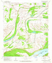
1964 Map of Friars Point NW
USGS Topo · Published 1965About this map
Mississippi River bottomlands define this 1960s landscape, where the shifting hydrology of St Francis Lake and Horn Lake created a complex system of oxbows and sloughs. The geography is marked by the massive Levee protecting the low-lying fields of Phillips County from the river's influence. This era shows a rural community anchored by small landmarks such as Little Zion Ch, Point Pleasant Ch, and New Hope Ch. The prevalence of family-named sites like Preston Place and several small burial grounds, including Maney Cem and Brown Cem, provides significant detail for local history research. Agricultural drainage and water management are evident through features like Beaver Bayou and Missouri Slough, which weave through the terrain between the river and the older lake beds.
Find a feature on this map
33 named features on this map. Tap any name to fly to it.
Don’t see what you’re looking for? This feature index may not catch every label — zoom into the map to look around manually.
Map Details
Editions of this 1964 Friars Point NW Map
2 editions found
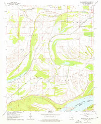
Other maps of this area

1908 · Coahoma
USGS Topo · 1:24,000

1908 · Moon Lake
USGS Topo · 1:24,000

1910 · Coahoma
USGS Topo · 1:31,680

1912 · Moon Lake
USGS Topo · 1:31,680

1939 · Farrell
USGS Topo · 1:62,500

1939 · Modoc
USGS Topo · 1:62,500

1939 · Latour
USGS Topo · 1:62,500

1940 · Marvell
USGS Topo · 1:62,500

1948 · Helena
USGS Topo · 1:250,000

1948 · Modoc
USGS Topo · 1:62,500