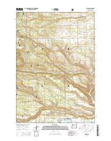
2014 Map of Friend
USGS Topo · Published 2014About this map
Friend and the surrounding high-country landscape of Wasco County sit at the edge of the Mount Hood National Forest, where agricultural plateaus meet wooded drainages. The small community and its adjacent Friend Cem are the focal point for a network of local roads including Clark Mill Rd and Heberlein Rd. The terrain is deeply incised by watercourses such as Tygh Cr and Jordan Cr, which flow through features like Gurley Canyon and past Owl Hollow.
Find a feature on this map
42 named features on this map. Tap any name to fly to it.
Don’t see what you’re looking for? This feature index may not catch every label — zoom into the map to look around manually.
Map Details
Editions of this 2014 Friend Map
This is the sole edition of this map. No revisions or reprints were ever made.
Other maps of this area

1930 · Dufur
USGS Topo · 1:125,000

1934 · Dufur
USGS Topo · 1:125,000

1953 · The Dalles
USGS Topo · 1:250,000

1956 · The Dalles
USGS Topo · 1:250,000

1957 · The Dalles
USGS Topo · 1:250,000

1962 · Wolf Run
USGS Topo · 1:24,000

1962 · Rock Creek Reservoir
USGS Topo · 1:24,000

1962 · Postage Stamp Butte
USGS Topo · 1:24,000

1962 · Wamic
USGS Topo · 1:24,000
1962 · Tygh Valley
USGS Topo · 1:24,000