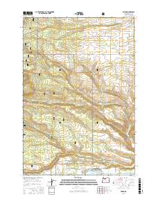
2017 Map of Friend
USGS Topo · Published 2017About this map
Friend and the surrounding Wasco County uplands are defined by a network of creeks and irrigation infrastructure on the eastern edge of the Mount Hood National Forest. In the southern portion of the map, Pine Hollow sits adjacent to the Pine Hollow Reservoir, supported by the Pine Hollow Airport and a grid of residential roads like N Circle Dr and N Sentosa Lake Rd. The landscape's agricultural and hydrologic history is evident in features like Highlands Ditch and Sherar Springs.
Find a feature on this map
46 named features on this map. Tap any name to fly to it.
Don’t see what you’re looking for? This feature index may not catch every label — zoom into the map to look around manually.
Map Details
Editions of this 2017 Friend Map
This is the sole edition of this map. No revisions or reprints were ever made.
Other maps of this area

1930 · Dufur
USGS Topo · 1:125,000

1934 · Dufur
USGS Topo · 1:125,000

1953 · The Dalles
USGS Topo · 1:250,000

1956 · The Dalles
USGS Topo · 1:250,000

1957 · The Dalles
USGS Topo · 1:250,000

1962 · Wolf Run
USGS Topo · 1:24,000

1962 · Rock Creek Reservoir
USGS Topo · 1:24,000

1962 · Postage Stamp Butte
USGS Topo · 1:24,000

1962 · Wamic
USGS Topo · 1:24,000
1962 · Tygh Valley
USGS Topo · 1:24,000