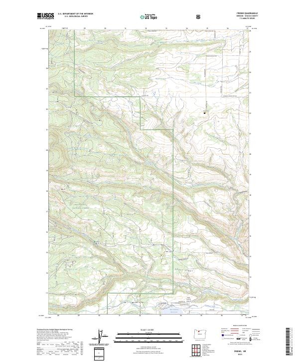
2023 Map of Friend
USGS Topo · Published 2023About this map
Happy Ridge and the high plateaus of Wasco County define this landscape, where the transition from managed timberlands to agricultural foothills is clearly marked. The Badger Creek Wilderness and Mount Hood National Forest dominate the western terrain, cut by rugged drainages like Gurley Canyon and the headwaters of Tygh Creek. Settlement patterns are concentrated toward the east, where the Pine Hollow Reservoir and the adjacent Pine Hollow Airport serve as a focal point for modern activity. Historical markers of the rural community remain visible through the Friend Cem and a network of legacy roads such as Kingsley-Friend Mkt Rd and Old Friend Rd. Water management infrastructure, including the Highland Ditch and numerous creek systems like Badger Creek, illustrates the essential role of irrigation in sustaining this high-elevation environment.
Find a feature on this map
44 named features on this map. Tap any name to fly to it.
Don’t see what you’re looking for? This feature index may not catch every label — zoom into the map to look around manually.
Map Details
Editions of this 2023 Friend Map
This is the sole edition of this map. No revisions or reprints were ever made.
Other maps of this area

1930 · Dufur
USGS Topo · 1:125,000

1934 · Dufur
USGS Topo · 1:125,000

1953 · The Dalles
USGS Topo · 1:250,000

1956 · The Dalles
USGS Topo · 1:250,000

1957 · The Dalles
USGS Topo · 1:250,000

1962 · Wolf Run
USGS Topo · 1:24,000

1962 · Rock Creek Reservoir
USGS Topo · 1:24,000

1962 · Postage Stamp Butte
USGS Topo · 1:24,000

1962 · Wamic
USGS Topo · 1:24,000
1962 · Tygh Valley
USGS Topo · 1:24,000