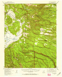
1953 Map of Frijoles
USGS Topo · Published 1958About this map
Ancient Pueblo Ruins and later Spanish land grants define this high-altitude landscape in the mid-1950s. The survey captures the complex intersection of the Santa Clara Indian Reservation and the Ramon Vigil Grant, bordering the protected canyons of Bandelier National Monument. The geography transitions from the volcanic high points of Cerro Grande and St Peters Dome down into a network of steep mesas, including Twomile Mesa and Frijoles Mesa.
Find a feature on this map
124 named features on this map. Tap any name to fly to it.
Don’t see what you’re looking for? This feature index may not catch every label — zoom into the map to look around manually.
Map Details
Editions of this 1953 Frijoles Map
Other maps of this area

1890 · Jemes
USGS Topo · 1:125,000

1892 · Jemes
USGS Topo · 1:125,000

1892 · Santa Clara
USGS Topo · 1:125,000

1909 · Gallina
USGS Topo · 1:125,000

1918 · Abiquiu
USGS Topo · 1:125,000

1937 · Jemez Springs
USGS Topo · 1:48,000

1943 · Jemez
USGS Topo · 1:62,500

1944 · Jemez Springs
USGS Topo · 1:62,500

1952 · White Rock
USGS Topo · 1:24,000

1952 · Valle Toledo
USGS Topo · 1:24,000