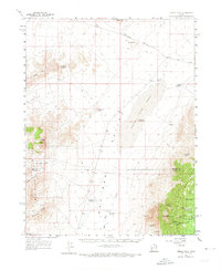
1960 Map of Frisco Peak
USGS Topo · Published 1973About this map
The San Francisco Mountains and the Wah Wah Mountains anchor this 1960s study of high-desert terrain in southern Utah. The map reveals a landscape defined by isolated water sources and mining activity, with numerous springs like Crystal Spring and Morehouse Springs supporting livestock operations at Bagnall Corral and Wild Horse Corral. The presence of the Two Rock Charcoal Kilns near Morehouse Canyon highlights the area's industrial history, where timber was processed for use in regional smelting.
Find a feature on this map
43 named features on this map. Tap any name to fly to it.
Don’t see what you’re looking for? This feature index may not catch every label — zoom into the map to look around manually.
Map Details
Editions of this 1960 Frisco Peak Map
2 editions found
Other maps of this area

1953 · Richfield
USGS Topo · 1:250,000

1958 · Richfield
USGS Topo · 1:250,000

1958 · Milford
USGS Topo · 1:62,500

1959 · Frisco
USGS Topo · 1:62,500

1960 · Frisco Peak
USGS Topo · 1:62,500

1960 · Wah Wah Summit
USGS Topo · 1:62,500

1960 · Beaver Lake Mts.
USGS Topo · 1:62,500

1960 · Crystal Peak
USGS Topo · 1:62,500

1960 · The Barn
USGS Topo · 1:62,500

1971 · Sewing Machine Pass
USGS Topo · 1:24,000