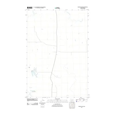
2011 Map of Froelich Dam
USGS Topo · Published 2011About this map
Froelich Dam serves as the primary landmark in this section of the Sioux County landscape, creating a local reservoir that interrupts the natural drainage of the region. The surrounding terrain is characterized by the expansive Little Heart Flats, a broad physiographic feature that defines the local topography south of the water. Winding through the northern and southern reaches of the quadrangle, Porcupine Creek provides the principal hydrological structure for this rural area. The map illustrates a sparse network of section-line roads and local routes typical of the North Dakota plains, reflecting a landscape dedicated to large-scale agriculture and open range, where water management features like the dam are central to the infrastructure of the Fort Yates District.
Find a feature on this map
3 named features on this map. Tap any name to fly to it.
Don’t see what you’re looking for? This feature index may not catch every label — zoom into the map to look around manually.
Map Details
Editions of this 2011 Froelich Dam Map
This is the sole edition of this map. No revisions or reprints were ever made.
Other maps of this area

1954 · Bismarck
USGS Topo · 1:250,000

1958 · Bismarck
USGS Topo · 1:250,000

1971 · Barren Butte
USGS Topo · 1:24,000

1971 · Half Timber Butte
USGS Topo · 1:24,000

1971 · Froelich Dam
USGS Topo · 1:24,000

1971 · Solen SW
USGS Topo · 1:24,000

1971 · Porcupine
USGS Topo · 1:24,000

1971 · Timmer
USGS Topo · 1:24,000
1971 · Selfridge SE
USGS Topo · 1:24,000

1971 · Selfridge
USGS Topo · 1:24,000