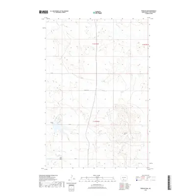
2018 Map of Froelich Dam
USGS Topo · Published 2018About this map
Froelich Dam and its surrounding watershed define this portion of the Fort Yates District in Sioux County. The landscape is characterized by the prominent elevation of the Porcupine Hills in the southeast, contrasting with the lower drainage of Porcupine Cr which meanders through the northern sections. This topography informs the local road network, including Bia Rd 7 and Bia Rte 7, which navigate the rises and falls of the terrain.
Find a feature on this map
12 named features on this map. Tap any name to fly to it.
Don’t see what you’re looking for? This feature index may not catch every label — zoom into the map to look around manually.
Map Details
Editions of this 2018 Froelich Dam Map
This is the sole edition of this map. No revisions or reprints were ever made.
Other maps of this area

1954 · Bismarck
USGS Topo · 1:250,000

1958 · Bismarck
USGS Topo · 1:250,000

1971 · Barren Butte
USGS Topo · 1:24,000

1971 · Half Timber Butte
USGS Topo · 1:24,000

1971 · Froelich Dam
USGS Topo · 1:24,000

1971 · Solen SW
USGS Topo · 1:24,000

1971 · Porcupine
USGS Topo · 1:24,000

1971 · Timmer
USGS Topo · 1:24,000
1971 · Selfridge SE
USGS Topo · 1:24,000

1971 · Selfridge
USGS Topo · 1:24,000