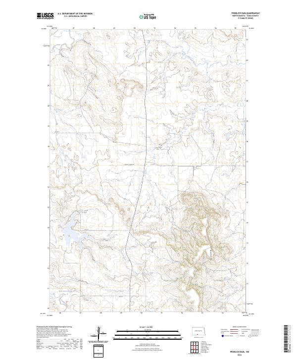
2024 Map of Froelich Dam
USGS Topo · Published 2024About this map
Porcupine Hills dominate the southeastern landscape of this Sioux County region, providing a significant vertical contrast to the surrounding terrain. This modern survey illustrates the current drainage patterns and road infrastructure within the Standing Rock Reservation area, where Porcupine Creek winds through the northern and southwestern sections. The map reveals a land defined by high plateaus and lower drainage basins like Little Heart Flats. Local transportation is primarily facilitated by a network of rural routes, including Froelich Dam Rd, BIA Rd 7, and BIA Rte 7, which navigate the township lines of t132n r82w and t131n r82w. This topography highlights the sparse settlement patterns and the vast open character of the North Dakota prairie.
Find a feature on this map
11 named features on this map. Tap any name to fly to it.
Don’t see what you’re looking for? This feature index may not catch every label — zoom into the map to look around manually.
Map Details
Editions of this 2024 Froelich Dam Map
This is the sole edition of this map. No revisions or reprints were ever made.
Other maps of this area

1954 · Bismarck
USGS Topo · 1:250,000

1958 · Bismarck
USGS Topo · 1:250,000

1971 · Barren Butte
USGS Topo · 1:24,000

1971 · Half Timber Butte
USGS Topo · 1:24,000

1971 · Froelich Dam
USGS Topo · 1:24,000

1971 · Solen SW
USGS Topo · 1:24,000

1971 · Porcupine
USGS Topo · 1:24,000

1971 · Timmer
USGS Topo · 1:24,000
1971 · Selfridge SE
USGS Topo · 1:24,000

1971 · Selfridge
USGS Topo · 1:24,000