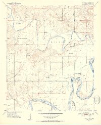
1951 Map of Frogville
USGS Topo · Published 1952About this map
The winding Kiamichi River defines the landscape of southeastern Oklahoma in the early 1950s as it meanders toward its confluence with the Red River at the Texas border. This riverine environment is marked by significant topographical features such as Wilson and Everidge, where local life is centered around a network of country schools and rural churches. The map highlights a transition in community infrastructure, noting the Rosermound Sch (Abandoned) alongside active institutions like Eastern Star Sch and St Johns Ch.
Find a feature on this map
31 named features on this map. Tap any name to fly to it.
Don’t see what you’re looking for? This feature index may not catch every label — zoom into the map to look around manually.
Map Details
Editions of this 1951 Frogville Map
3 editions found
Other maps of this area

1901 · Alikchi
USGS Topo · 1:125,000

1950 · Mcalester
USGS Topo · 1:250,000

1951 · Slate Shoals
USGS Topo · 1:24,000

1951 · Frogville
USGS Topo · 1:24,000

1951 · Shoals
USGS Topo · 1:24,000

1951 · Kiomatia
USGS Topo · 1:24,000

1951 · Woodland
USGS Topo · 1:24,000

1951 · Manchester
USGS Topo · 1:24,000

1953 · Texarkana
USGS Topo · 1:250,000

1956 · Texarkana
USGS Topo · 1:250,000