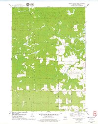
1978 Map of Fromm Lookout Tower
USGS Topo · Published 1979About this map
The northern Wisconsin timberlands of Harding and Corning are defined by the branching waterways of the Copper River system. The North Fork Copper River, Middle Fork Copper River, and South Fork Copper River dominate the landscape, carving through a region marked by extensive wetlands and seasonal roads like Swampy Road. This late-1970s landscape shows the transition of old industrial infrastructure into local landmarks, specifically where the Old Railroad Grade and Old RR Gr cut through the forest, tracing the routes once used for logging.
Find a feature on this map
22 named features on this map. Tap any name to fly to it.
Don’t see what you’re looking for? This feature index may not catch every label — zoom into the map to look around manually.
Map Details
Editions of this 1978 Fromm Lookout Tower Map
This is the sole edition of this map. No revisions or reprints were ever made.
Other maps of this area

1902 · Marathon
USGS Topo · 1:125,000

1945 · Rib Lake
USGS Topo · 1:48,000

1947 · Rib Lake
USGS Topo · 1:48,000

1949 · Rib Lake
USGS Topo · 1:48,000

1950 · Spirit Falls
USGS Topo · 1:48,000

1951 · Athens
USGS Topo · 1:48,000

1951 · Hamburg
USGS Topo · 1:48,000

1952 · Spirit Falls
USGS Topo · 1:48,000

1953 · Rice Lake
USGS Topo · 1:250,000

1954 · Iron Mountain
USGS Topo · 1:250,000