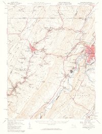
1950 Map of Frostburg
USGS Topo · Published 1960About this map
Savage Mountain and Dans Mountain dominate the topography of this Allegany County region, where the ridge-and-valley landscape of the mid-twentieth century is defined by its deep coal mining roots and heavy rail infrastructure. The industrial activity of the era is evidenced by numerous Strip Mines and specialized company settlements like Borden Shaft and Klondike. Strategic transportation corridors like the National Pike and the Cumberland and Pennsylvania railroad navigate the gaps and narrows, connecting centers like Frostburg and Mount Savage to the bustling hub at Cumberland Airport. Genealogists will find a wealth of local landmarks, from family-named sites like Sampson Rock and Loar Hill to a significant number of rural burial grounds, including the Rose Meadow Cemetery and Warner Cemetery. The map also captures the transition from Maryland into Pennsylvania and West Virginia along the Potomac River and Wills Creek.
Find a feature on this map
160 named features on this map. Tap any name to fly to it.
Don’t see what you’re looking for? This feature index may not catch every label — zoom into the map to look around manually.
Map Details
Editions of this 1950 Frostburg Map
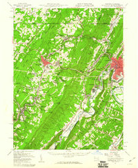
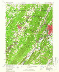
3 editions found
Other maps of this area

1891 · Romney
USGS Topo · 1:125,000

1895 · Piedmont
USGS Topo · 1:125,000

1898 · Frostburg
USGS Topo · 1:62,500

1899 · Flintstone
USGS Topo · 1:62,500

1899 · Grantsville
USGS Topo · 1:62,500

1900 · Flintstone
USGS Topo · 1:62,500

1901 · Frostburg
USGS Topo · 1:62,500

1904 · Grantsville
USGS Topo · 1:62,500

1908 · Frostburg
USGS Topo · 1:62,500

1919 · Elk Garden
USGS Topo · 1:48,000