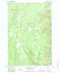
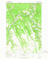
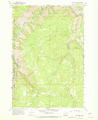
1967 Map of Fry Meadow
USGS Topo · Published 1983About this map
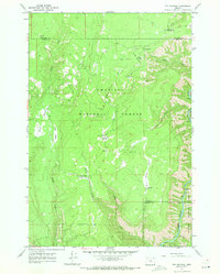
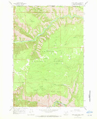
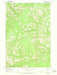
The Grande Ronde River carves through the northeastern corner of the Blue Mountains, defining a rugged landscape of high meadows and administrative outposts in the late 1960s. This survey, updated with 1980s data, details a remote region of the Umatilla National Forest and Wallowa-Whitman National Forest where resource management and early recreation intersect. Remote structures like the Kettleson Pearson Cabin and the Fry Meadow Guard Sta indicate the deep-woods habitation required for forest oversight, while the Lookout Tower on Lookout Mountain provided a critical vantage point for fire detection. Numerous grazing and riparian features, including Jaussaud Corral, Brock Meadow, and Jarboe Meadow, speak to the seasonal ranching history of these uplands. Evidence of light industrial use appears near Bear Canyon Campground in the form of a Gravel Pit, supporting the network of forest roads and jeep trails that navigate the drainage of Sheep Creek.
Find a feature on this map
26 named features on this map. Tap any name to fly to it.
Don’t see what you’re looking for? This feature index may not catch every label — zoom into the map to look around manually.
Map Details
Editions of this 1967 Fry Meadow Map
3 editions found
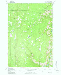
Other maps of this area

1955 · Grangeville
USGS Topo · 1:250,000

1959 · Grangeville
USGS Topo · 1:250,000
1964 · Partridge Creek
USGS Topo · 1:24,000
1964 · Howard Butte
USGS Topo · 1:24,000
1964 · Rondowa
USGS Topo · 1:24,000
1967 · Fry Meadow
USGS Topo · 1:24,000
1967 · Elbow Creek
USGS Topo · 1:24,000
1967 · Bone Spring
USGS Topo · 1:24,000
1967 · Deep Creek
USGS Topo · 1:24,000
1967 · Wenaha Forks
USGS Topo · 1:24,000